A man who had become disoriented on the moors near the Pentland Road in the centre of Lewis was located safe and well during the night. As darkness fell on Friday evening, he contacted the Coastguard by mobile phone saying he had lost his bearing in mist and fog near the Pentland Road. Coastguard teams searched the area on foot during the night. Once the helicopter became available after a medical emergency near Inverness, its crew located the man by the light on his mobile phone at 2 am.
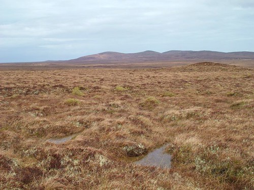
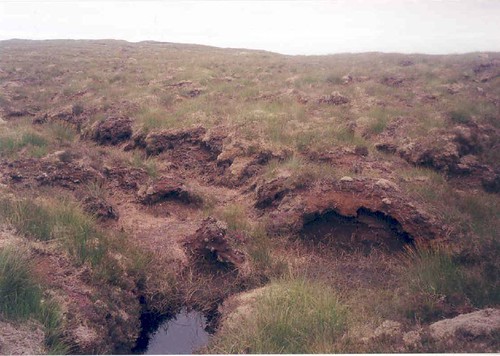
I have visited that part of Lewis several times on foot my self, but would not have done so yesterday because it was drizzling. When I was doing long walks, back in 2005, I would venture out in all weathers - but not to the moors with visibility as poor as yesterday. However, fog and mist can catch anyone out, and I'm glad this person was finally located safe and sound. Just a few images of the area to indicate the terrain.
Cheeze Arnish, ankle breaking pics, glad they found him
ReplyDeleteNot many landmarks to orient by even if the mist isn't thick! Aren't mobile phones wonderful, I find the wee torch really useful in all kinds of situations.
ReplyDeleteAll's well that ends well. For a moment I had thought the title of your posting was "Lost the Moor" - further hints of Shakespeare, but this time the Bard in a strange multi-culti, hail to Diversity mood. Lost the Moor would have been quite appropriate for Valentine's Day, certainly not any less than the Romeo nonsense. Not all the roses of Barbary would have saved Desdomena (and Othello) from the weavings of Iago.
ReplyDeleteStory has been picked up by the BBC: http://news.bbc.co.uk/1/hi/scotland/highlands_and_islands/7890046.stm
ReplyDeleteI drive along the Pentland Road every day, indeed I live on it!!
So easy to get lost on the Lewis moors even in good weather. Did an easy walk from Barvas round Loch Na Muilne to Bru last week which had a cross moorland section. Was disorientated when the wind blown waymarkers disappeared and admit to a moment or two of uncertainty as the sun was going down. A quick compass check bailed me out but I'd never wander far without the Silva and map. The moor can be really heavy going at the best of times, full of ditches and pools of water. Sod doing it in fog and dark.
ReplyDeleteP.S. the iPhone maps was useless when I checked it. Put me in a rough area from Ness to Bernera :)
arnish --have photo i took poutside port vila in vanuatu which will interst you--will send it via the bbc ib site as i still cant send photos through this one--P.S take something very strong to calm your nerves,,you will really need to!
ReplyDeleteMust be a war memorial...
ReplyDeleteOr a wind turbine!!
ReplyDeleteWhen I lived on the mainland near the moors - I always respected their status - avoid in adverse weather.
ReplyDeletePleased he was located safely.
Once Pete Hag gets a hold of you there's no knowing what may happen. When I see pictures of that landscape it makes me think of the Dead Marshes in Lord of The Rings, with all the drowned faces staring up out of the noisesome water...*shudder*
ReplyDelete@thecroft: same issue with Google Maps on mobile. When in Achmore, my phone told me I was in Balallan once and Eisgean another time. General health warning, I guess, is don't rely on your mobile phone for navigation purposes here!
ReplyDeleteIt's a funny old world when you start relying on a telephone for navigational purposes. Where's me prismatic compass?
ReplyDelete