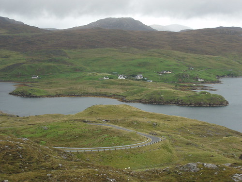
[caption id="" align="alignnone" width="500" caption="Keose Harbour"]
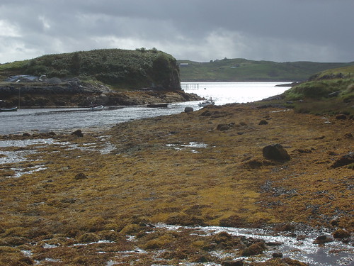 [/caption]
After freeing a small bird, that had managed to get itself locked into a creel, we had a look round and returned to the main road. Lunch was taken at the Loch Erisort Inn, in the shape of fish and chips. This used to be operated as the Claitair Hotel (still on the beer sign), but was refurbished a few years ago. The Loch Erisort Inn stands in the district of South Lochs, which I know very well after staying there through the winter of 2004/5. Nothing has changed round there.
[caption id="" align="alignnone" width="500" caption="Kinloch Seaforth"]
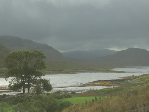 [/caption]
On up another side road, to Eishken. If only to see it whilst there are no wind turbines on the hills. It is a wild and desolate area, with a savage natural beauty. Its native inhabitants were removed to make way for sheep. I think the year 1820 is still referred to as the Year of the Sheep. Eishken Lodge is the base for shooters and fishers who go round the empty peninsula, which once hosted 36 villages. Back on the main road, I found a new memorial to that disaster of Scottish history called Bonnie Prince Charlie.
[caption id="" align="alignnone" width="500" caption="Monument for Bonnie Prince Charlie at Arivruaich"]
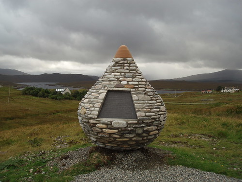 [/caption]
He had landed at Arivruaich (according to the memorial, although my info says it was on an island near Lemreway, 20 miles to the east) and sneaked over to Kildun Cottage at Arnish (just across the water from my current position) to request sanctuary in Stornoway. The burghers declined this hot potato but didn't shop BPC either.
[caption id="" align="alignnone" width="500" caption="Low clouds on the Clisham Pass"]
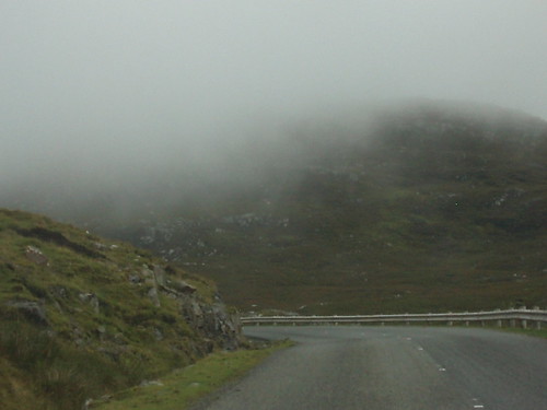 [/caption]
Crossed the border into Harris and promptly drove into the clouds (at 500 feet above sealevel) on our way to Rhenigidale. This village didn't have a road until 1987 - everything had to be brought in by boat or on foot. The main village in Harris, Tarbert, is 4 miles away, but that involves an ascent of 1,000 feet along a 1 in 2 incline. Upon return to Stornoway, I found I had taken 192 pictures today.
[caption id="" align="alignnone" width="500" caption="Maaruig from the Rhenigidale road"]
 [/caption]
192 pictures! Well done, AL. These photos are super, and truly reflect the atmosphere of the islands. I like the Clisham Pass one in particular.
ReplyDeleteOnly 192 Photos, so you dont use your camera much then LOL
ReplyDeleteWill you be posting them on to flickr or the like soon.
if they are anything like the ones you have posted they will be well worth viewing. Keep on snapping for the poor people who cannot get up to Lewis or Harris.
Beautiful day out, and fantastic phots.
ReplyDeleteVery atmospheric...and very West Coast weather, even if it was the east coast of the West Coast...
ReplyDeletestunning images mate, and reading all the you information to is very intresting thanks mate
ReplyDelete